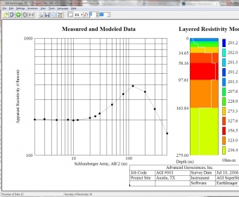
EarthImager 1D is an inversion modeling software program used to interpret one-dimensional electrical resistivity data and reveal a layered model of subsurface geology. EarthImager 1D can process vertical electrical sounding (VES) data collected with Schlumberger, Wenner, dipole-dipole, pole-pole, and various other arrays.
Comments (1)